Frost Report
Missouri Report on Damage to Grapevines from Frost/Freeze Events During April through May 11, 2020
Contents:
Frost/Freeze Events April 9-16
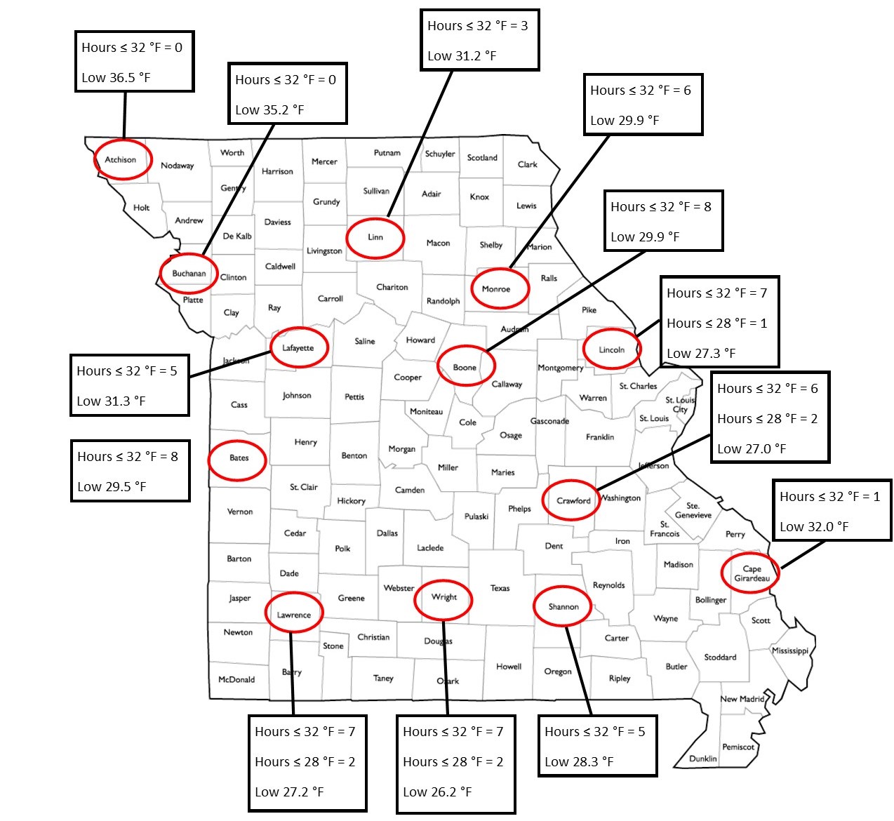
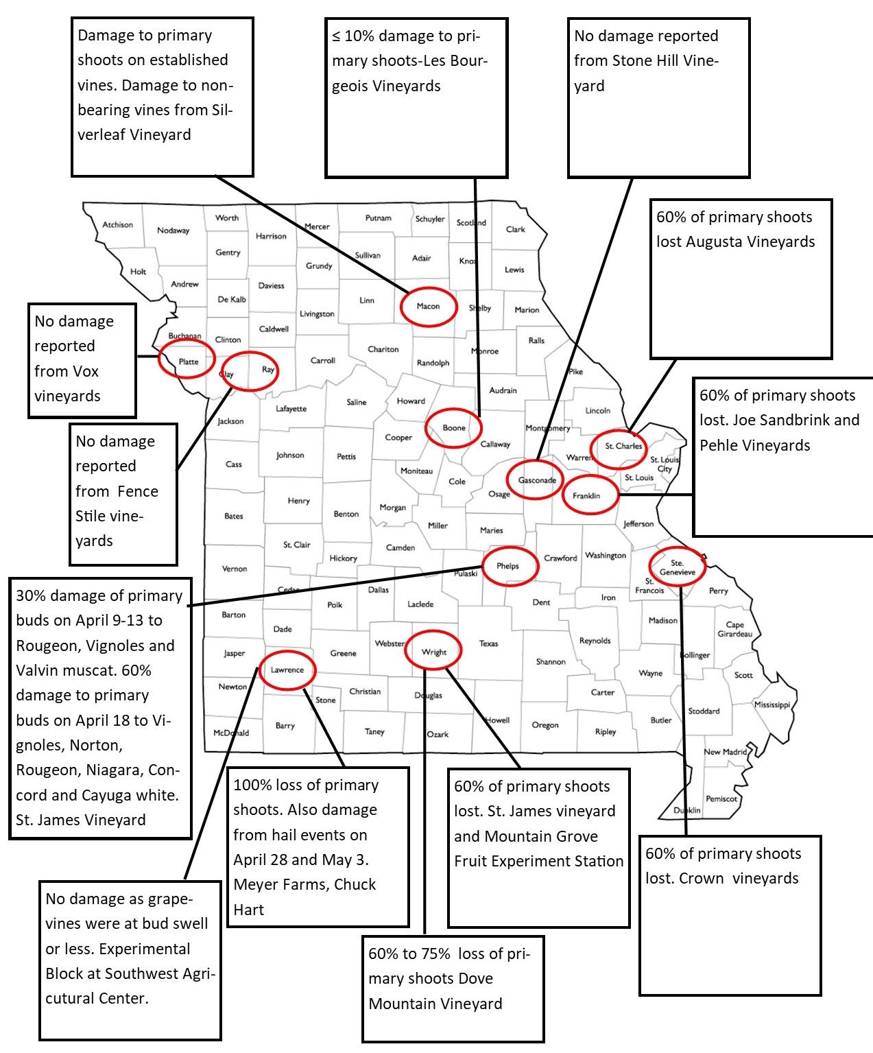
Grape cultivars that had advanced phenology past bud burst experienced damage from frost/freeze events that occurred mainly during April 10, 14, 15, and 16, 2020. Reports from growers suggest that areas in south central, southeast and east central areas had the most damage. Grapevines at bud burst are susceptible to damage to temperatures that fall below 27°F. In many areas in Missouri, low temperatures were recorded that were below 27°F for April 10, 14, 15, and 16. The most damage reported for this time period was from St. Genevieve, Wright, and Phelps counties all located in the South Central to Southeast Missouri area. Damage was mainly to grape cultivars that had advanced beyond full bud swell and were at bud-burst or beyond.
Frost/Freeze Events April 17-18
Most counties in Missouri were impacted by a radiation frost/freeze event on April 17-18, 2020. Many counties experienced a long duration of frost below 32°F (Figure 1). Counties located in southern to East Central Missouri recorded the longest duration of temperature below 28°F. Vineyards in these counties also reported the most damage (Figure 2). A vineyard located in Lawrence county reported 100% loss of primary shoots, moving east to Wright County damage reported 60 to 75% loss of primary shoots, and moving East to Ste Genevieve County damage was reported as 60% of primary shoots. Damage was also reported East Central Missouri with damage reported as 60% loss of primary shoots.
Frost/Freeze Events May 9 and 11
Frost events occurred on Saturday morning May 9 and Monday morning May 11, 2020. These frost events were short duration and temperatures in most counties remained at or just under 32°F. Vineyard growers in Figure 2 reported no damage from these frost events in May. I would add that it is difficult to discern damage from multiple frost events. When temperatures are below freezing the damage is cumulative.